0

Beomeosa Temple

This is a Busan Ex-Pat City Guide post. Check out the rest of my list here.

Photos by Stephanie Pellett. Check out her personal blog here, her Flickr account here, and her Instagram here for more beautiful photography.

“There is a well on the top of Mt. Geumjeongsan and the water of that well is gold. The golden fish in the well rode the colourful clouds and came down from the sky. This is why the mountain is named Geumsaem (gold well) and the temple is name ‘fish from heaven’.”

This summary of the origins of Beomeosa Temple’s etymology is from the Donggukyeojiseungram, a Korean geography book. Nestled up in the mountains, Beomeosa, like all good temples is remote, offering a peaceful, cultural day trip for tourists (like me!)

Admittedly, I had been informed that Beomeosa Temple was “pretty, but nothing special” from a few people. Regardless, I was eager to visit and form my own opinions about “the temple where the Nirvana fish play”.

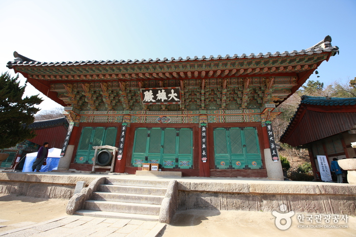
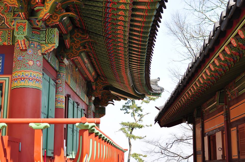
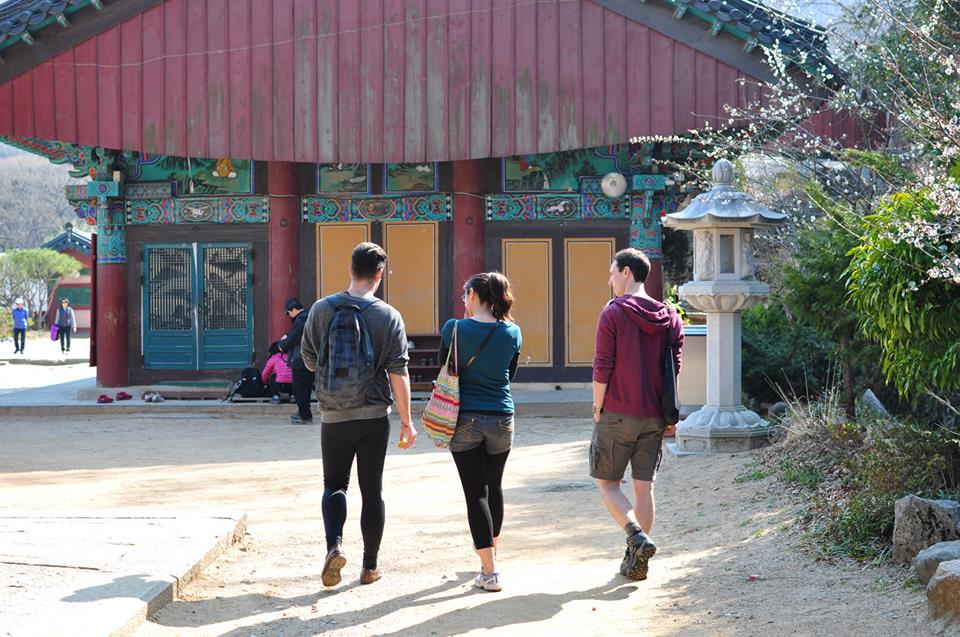
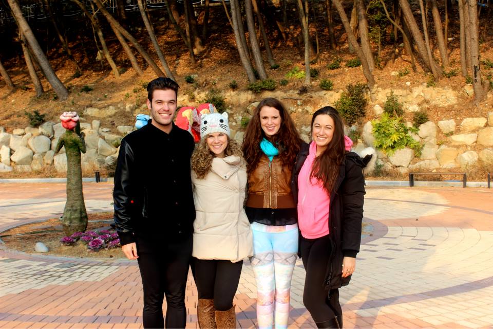
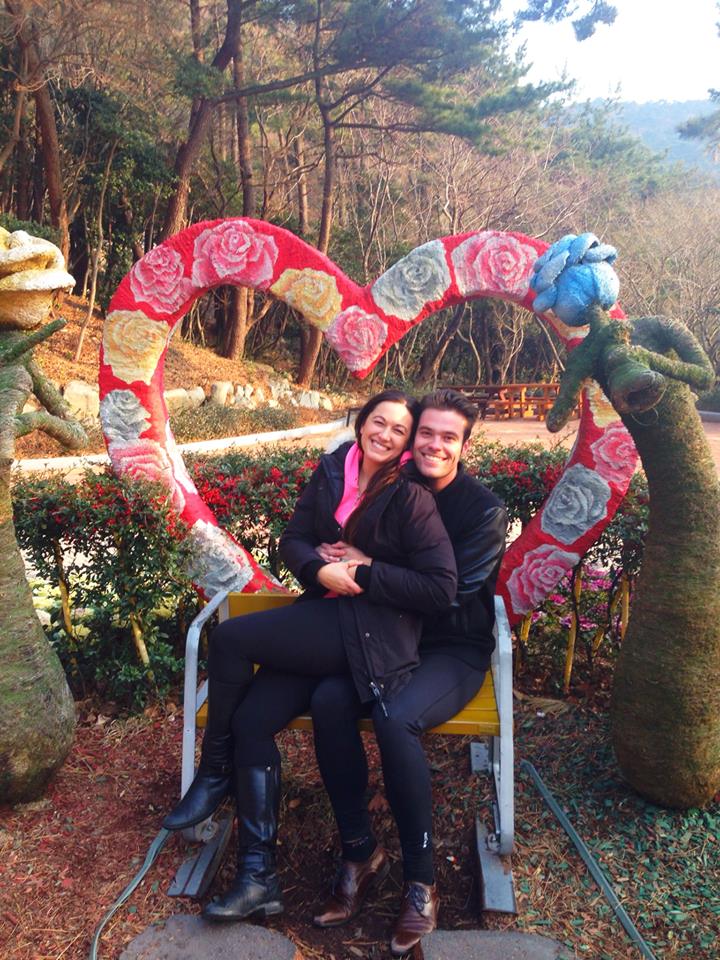
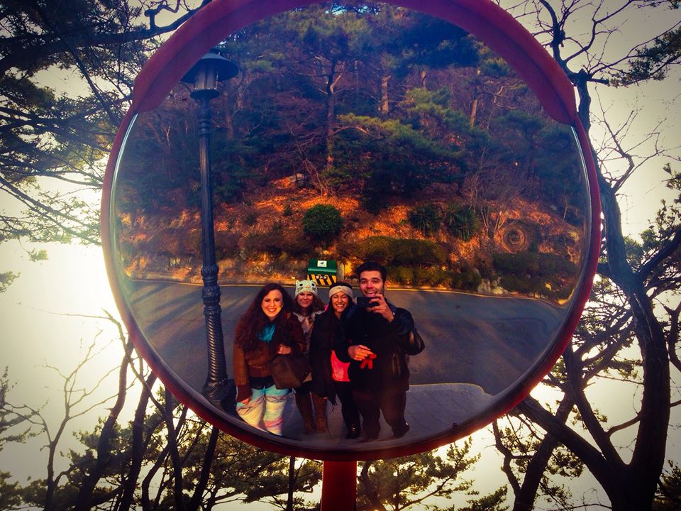
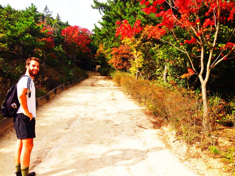
I visited Beomeosa on a day when spring was positively springing with Steph, my co-worker Robert, and his fiancé Anna. As soon as we stepped upon the temple grounds, I could feel how hallowed and sacred they were. We followed a row of wisteria trees up to the main compound, which houses a three-story pagoda, multiples shrines, and approximately a dozen hermitages, presumably for the fighting monks who called Beomeosa home. I’m always amazed at the intricacies and attention to detail when studying the colourful shrines and gates at Korean temples. I found it inspiring. Like, if someone could spend all that time designing something so beautiful, then I can at least floss every day or blog three times a week, right?

Beomeosa, itself, was lost twice; first, in the 16th century at the hands of the pyro-happy Japanese invaders, and second, a mere decade later in an accidental fire. It was rebuilt in the 17th century. These days, however, it is still undergoing a “temple facelift”. There was, in fact, ongoing construction on a couple of the hermitages and halls while we were visiting. Whoever said cosmetic surgery in Korea is just for people was dead wrong.

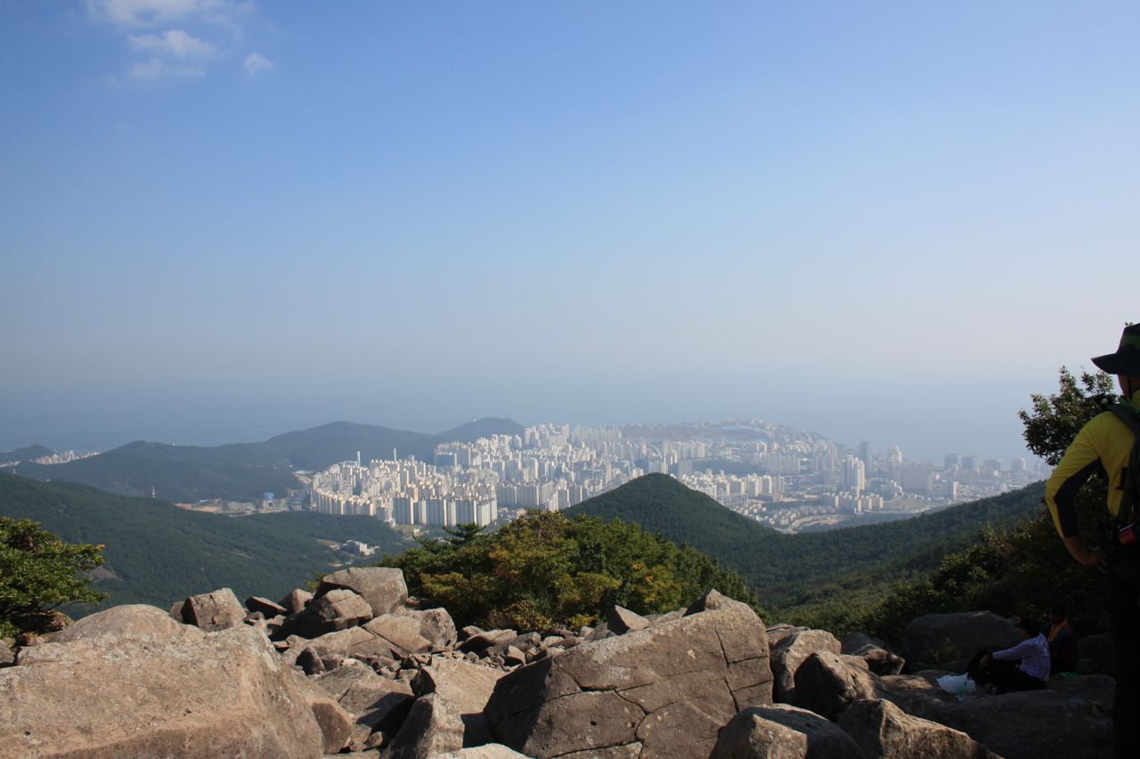
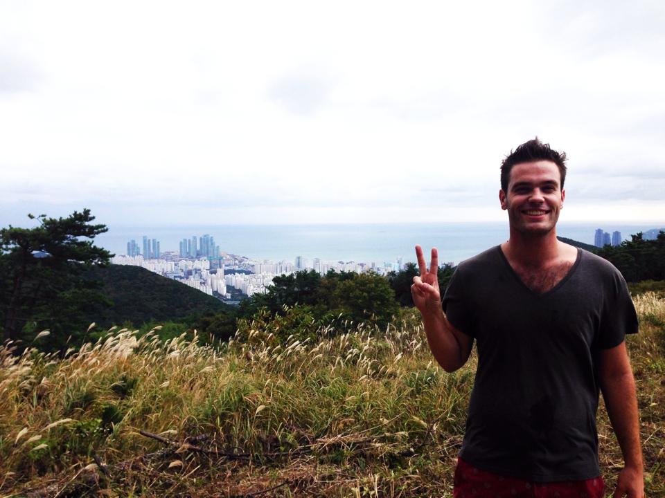
Oddly enough, my favourite part of my time at Beomeosa was spent in a rather unique rock field, with a quiet stream running through it. Steph, Robert, Anna, and I sat for a while in a circle on the rocks, and even took a few moments to dip our hands and feet into the chilly water. I’m hoping to visit Beomeosa again so I can follow this path of rocks up to the North Gate of the Geumjeongsanseong Fortress, because I’m all about that hiking sweat life on summer days.

In addition, the four of us visited the Seongdo Museum, located on the temple grounds. There were a variety of Buddhist antiquities, including a Lego construction of the “Nirvana Fish”, where Beomeosa derives its name from. Bizarrely, this Lego “masterpiece” seemed to be a bigger deal than the relics that were hundreds of centuries old. Just nod and smile, y’all.

Beomeosa is one of the most important temples in all of Korea, and receives extra credit for its “Temple Stay” program. While I found the Haedong Yonggungsa Water Temple more visually pleasing, the tranquility of Beomeosa Temple was a welcomed sort of beauty. My recommendation? Visit Beomeosa on a sunny day, walk the grounds, have a picnic on the rocks, and continue up Mount Geumjeongsan. Then you’ll really be about that sweat life.

Directions
To get to Beomeosa Temple, take the Orange Line on the Busan Subway (Line 1) to Beomeosa Station (stop 133). Take exit 5 or 7 and turn up the road between the exits. After 5 minutes, you will reach the Samsin bus stop. Bus Take bus #90, and get out at the Beomeosa Temple stop (approximately 15 minutes).  Alternatively, a taxi costs approximately ₩6,000.

0

Taejongdae Resort Park

This is a Busan Ex-Pat City Guide post. Check out the rest of my list here.

Photos by Jess Sternberg. Follow her on Instagram here.

As a Canadian boy who has experienced some twenty-two winters in Southeastern Ontario, the relatively temperate climate of Busan has been a dream during the typically harsh winter months. Besides one day in mid-February when it “snowed” (read: there was light snowfall that evaporated before it even touched the ground), on the whole, the South Korean winter has treated me well. It has also given me the ability to remain active and explore the great outdoors of Busan during months where, in Canada, I would be hermitting indoors.

Taejongdae Resort Park, located on the southern coast of Busan in Yeongdo-gu, provided a perfect setting for exploring the great outdoors, in the form of a crisp January afternoon stroll. The weather on this particular Saturday felt like a late October day in Canada, so my fellow Toronto girls, Jess, Maddie, Mary, and I took advantage and ventured to the famous Busan monument to take some yoga photos and watch the sunset.

Taejongdae derives its name from King TaeJong Mu-Yeol of the Silla Dynasty (BC57 until AD 935) who used to fire arrows along this beautiful coastal area back in his heyday. The park is absolutely magnificent – serene forests, breathtaking views of the coast, and beautiful man-made monuments. The park itself is quite sprawling, so in order to reach the main attraction, the Taejongdae Lighthouse, in an expedient manner, the park’s Danubi train is almost necessary to save yourself a long journey on foot. Unfortunately, the girls and I mistook the line that was simply waiting to board the Danubi train as the line waiting to purchase tickets for the train, became impatient, and started walking along the road towards the sites of Taejongdae. [Note: We never made it to the lighthouse. All of the sads.]

While we never made it to the lighthouse or Sinseon Rock, (which according to myth was a relaxation spot for gods and goddesses), we did get to see Taejongdae’s beautiful Pebble Beach from one of the many observatories along the coastline. Mary and I surged ahead to visit the Taejongdae observatory, which provided some stunning views of the rocky Korea Strait and the famous “Suicide Rock”. A sombre statue of a mother with two children stands just outside the observatory to remind anyone who has ventured to Taejongdae to commit suicide that somewhere, their mother holds an unconditional love for them. The observatory was unfortunately our last stop before turning back, but provided us with some unforgettable panoramic views and interesting information about the “Taejong Rain” which happens around the 10th of May (on the Lunar calendar). As a result, Taejongdae serves as a famous site for rain prayers during droughts.

Eventually, the girls and I headed back towards the Pebble Beach, finding a quiet part of the forest where we could watch the sunset, undisturbed. Just to our left, we discovered a giant boulder on the coast, absolutely perfect for some sunset yoga photos. One at a time, we each slowly and surely crawled our way onto the rock, making sure we didn’t look down at the deep plunge beneath us should our loafers or Toms fail us. A couple of “rock”-solid warrior, mermaid, and lotus poses later, the girls and I left the park, while the sun finally set on the magnificent coastal park.

Directions
To reach Taejongdae Resort Park, take the Busan Subway Red Line (Line 1) to Busan Station (stop 113). From here, take Bus 88 or 101 until the Taejongdae Park stop (approximately 35 minutes). Alternatively, you can take Line 1 to Nampo (stop 111) and take a 20 minute cab ride to Taejongdae. Entrance is free. For those who want to explore Taejongdae without walking, the Danubi Train provides transportation for W1,500, as well as service in English, Korean, and Chinese.

0

Jangsan Mountain

This is a Busan Ex-Pat City Guide post. Check out the rest of my list here.

Dylan Teacher: “Good afternoon, readers!”

Readership: “Good afternoon, Dylan Teacher!”

Dylan Teacher: “Before we get started today, I have a very quick and relevant trivia question and the first student to answer will get a special star sticker!”

Readership: *deafening cheers*

Dylan Teacher: “Okay. What percentage of Korea is considered mountainous?”

Readership: *deafening silence*

Sorry, y’all. Sometimes I seriously can’t help but revert to instructional, cooing baby voiced Dylan Teacher during my time away from school. The answer to the above question is “Approximately 70% of South Korea is considered mountainous.” Why is this relevant though? It’s relevant because up until 3 and a half weeks ago, I hadn’t taken advantage of this fun little fact. This is even sadder when I reveal that I live literally 20 minutes away from a large mountain chain called Jangsan Mountain. Luckily, this issue was rectified after I suggested a brisk midday hike to my visiting friend, Matt.

Our morning started off slightly rough after a whirlwind night in KSU, but we nonetheless dragged ourselves out of bed, suited up, and headed out to be amazed with an elevated view of the city.

As we approached the mountain, we began to notice an increase in outdoor and mountain equipment stores; a brilliant strategy, in my opinion, to draw hikers in for some impulse buys. I know I was certainly tempted to enter a shop and buy some proper hiking pants after catching a glimpse of my reflection in the window (read: I was wearing a gray v-neck and red swimming trunks).

Eventually, we reached the base of the mountain, which was fairly crowded on this particular Saturday morning. Many hikers had opted to picnic on various sprawling rock piles and quietly socialize beside the serene waterfall near the beginning of the trail.

The hike itself is moderately difficult. There was fairly steep stretch toward the beginning of our ascent, but we were able to take a quick rest once the trail reached a plateau, housing a Korean exercise park. Korea is still pretty temperate for this Canadian boy, but many ajummas outfitted in full-on hiking garb approached Matt and I, making a shivering motion to indicate their disbelief at our minimalist outfits. I smiled and mimed that I was a “crajiee waygook” and went on my merry way.

Despite our t-shirts and shorts, all of the $3 glasses of Cass we had consumed the night before began seeping mercilessly from our pores. This is all to say it was a rather moist hike, made all the more conspicuous by the fact that KOREANS LITERALLY NEVER SWEAT. Matt and I would be huffing and puffing and dripping and dropping up a slight incline, only to be passed effortlessly by a middle-aged couple somehow NOT completely drenched in sweat. However, once I remembered my yoga practice (“find your breath”) the hike became much more bearable.

We reached a lookout after almost an hour of hiking. The view of Busan from Jangsan Mountain is spectacular, all white, concrete, airy, ethereal. I wish I had more photos to show but my iPhone died after Matt and I listened to “When I’m Gone” by Anna Kendrick on repeat for about 20 minutes. #SorryNotSorry

After leaving the lookout, we continued up the mountain. Oftentimes, there were no signs (even in Korean) to point us to any particular path, so Matt and I usually chose a trail at random and hoped for the best (luckily, Matt was raised as a feral child in British Columbia, so his sense of direction was quite honed). Every once in a while, we would stumble across a farmer’s tiny bungalow and we even discovered a simple, yet surprisingly bustling restaurant on our way down.

By far the most insane thing we stumbled upon were dozens of (pretty graphic) land mine warning signs. I was slightly unnerved to say the least, but I bellowed “YOLO” and continued on our journey. In addition to the charming signs, there are green tarps everywhere covering woodpiles, and barbed wire to add to the “beautiful scenery that may literally BLOW you away” ambiance.

Unsurprisingly, our descent down Jangsan Mountain was quite speedy. I made sure to keep my weight over my knees since I am the king of twisting my ankle. We stopped at a random little kiosk and enjoyed some nice green apple popsicles on the way down, although they had nothing on my beloved Melon Pops. Once we reached the base, we air pressurized our shoes because it’s South Korea so WHY THE HELL NOT.

Overall, the views of Busan from atop Jangsan Mountain are worth feeling like a fat, panting Dachshund. Just maybe without the Cass beer the night before…

Directions
To get to Jangsan Mountain, take Line 2 (green line) on the Busan Subway to Jangsan Station (stop 201) and go out exit 10. Walk straight for about 20 minutes until you approach the foot of the mountain. The hike is however long you make it, but budget for about 2.5 hours.

The beautiful scenery may literally BLOW you away

The beautiful scenery may literally BLOW you away

Always with the peace sign, like the good Asian biddy I am

Always with the peace sign, like the good Asian biddy I am

Matt and his feminine shadow

Matt and his feminine shadow

1418344_10151776420912017_1911513015_n

Beautiful Busan

Beautiful Busan